Editor’s Note: This feature was originally published in the August/September 2014 issue of Adventure Cyclist magazine under the title “America’s Darling: Route 66”. We’re publishing it online for the first time in honor of Route 66’s 100 anniversary next year and our route’s 10th birthday this year.
It is Friday night, and with the last gasp of the day, a golden glow burns low across Central Avenue in Albuquerque, New Mexico. It throws a storied slant on the time-pitted windows of a blue 1968 Ford Mustang, cruising slowly in front of the bright lights of the KiMo Theater. Lost in the song of glass-pack mufflers burbling out V-8 song, we shuck and jive on pedals east on the avenue to the pink and teal neon of the Route 66 Diner where the promise of the past lives on. On Friday nights in Albuquerque, it’s not the best hour for bicycles, but we persist just as the legend of Route 66 persists in the dreams of people worldwide.
Pull open the door. Inside the Route 66 Diner, the needle drops on a 45 and “Tucumcari, Here I Come” by Dale Watson bursts out. A bubbly girl in a short dress and braces seats us on spinning stools on a long counter in front of an Elvis cutout and an old Schwinn cruiser. We order fizzing drinks, then walk around the restaurant looking at memorabilia — old road signs, a Pez collection, the cutt-off front of a Chrysler with the chrome still gleaming. This diner is the just the way I dream of old Route 66, but out on the road, of course, the story runs far deeper.
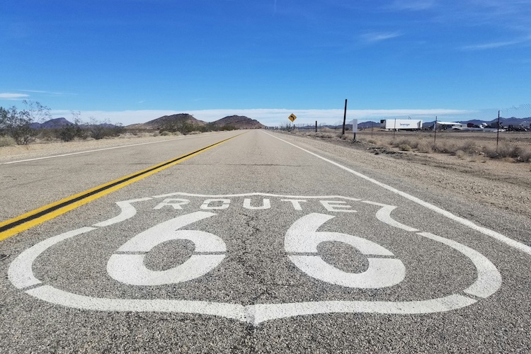
Next year, the Adventure Cycling Association will release their newest bicycle route, the fabled Route 66 from Chicago’s gleaming Miracle Mile to Santa Monica’s infinite blue waters. It’s a 2,448-mile (give or take) ribbon of highway — America’s Main Street — stretching out in front of your wheels like a road map to the promised land.
Route 66 still holds the lure of discovery and Americans love that promise of potential. Back in 1926. Right now. Tomorrow. I can’t define it, but there is certainly something about the idea of Route 66 that promises happiness. There is no better way to discover The Mother Road’s mysteries than to ponder them slowly at bicycle speed.
From Chicago, Route 66 starts down Jackson Boulevard, crosses Illinois and Missouri, tastes Kansas, and digs deep into Oklahoma, the Texas Panhandle, New Mexico, Arizona, and California — Lake Michigan to the Pacific Ocean. It’s a classic journey, best done in one push, but we decided to tackle it in bite-sized rides, bit by bit like a Dust Bowl jalopy that breaks down but keeps chugging when the time is right. We tasted our first slice of Route 66 pie by traveling from Romeroville to Gallup, a stretch across most of New Mexico that follows the pre-1937 route up through Santa Fe.
Why start in the middle? Why New Mexico? Simply put, for me it was the crux of the journey, the land where the culture noticeably changes, food grows spicier, hills thrust higher, and the history of the American West, just a generation or two ago removed form us, begins. We weren’t disappointed by Route 66 in New Mexico.
On paper, Route 66 was born on November 11, when the U.S. government officially linked up a collection of existing roads and named it double six. In New Mexico, the original was a teeth-chattering 501 miles of washboard dirt that S-curved across the state. Back then, there was no straight shot across the Enchanted State.
My wife Andrea and I started our tour in Las Vegas, a town just north of the proper route in Romeroville. The road comes into Las Vegas after long stretches of short grass prairie, persistent breezes, windmills, and long fence lines that fade straight into the distance. Then the road starts to roller coaster up and down through a canyon thick with red dirt, stone, and piñon pine. Stacked stone houses give in to gravity, a patient horse waits for dinner at a big porch tacked on to a tidy trailer house, and primered project cars erode in front yards, all under the brilliance of the New Mexico sky.
Rolling into town under black dripping fingers of clouds, Las Vegas speaks of modern America with box stores and chain hotels on its perimeter, the downtown chock-full of historic brick buildings — some restored to glory, others waiting for saviors. We pedaled through Las Vegas seeking out its gems — a mural on a brick wall and chopped smooth lowrider pickups with giant chrome grills so shiny they mirror the quiet Spanish-Mexican plaza with streets radiating out like the rays of the sun.
Las Vegas has more than 900 buildings on various historic registers, and it’s fascinating to ride around looking at them. Some may look familiar because, despite the diminutive size of Las Vegas, it’s a hotbed for Hollywood. Many well-known directors have filmed scenes here over the decades. The list of films is too long to name, but suffice it to say that every step you take in this town follows the steps of one movie star or another.
In the last hours of the day, we rode out of town a few miles to “The Castle,” a stunning edifice on the mountainside that is currently home to the Armand Hammer United World College of the American West. Security guards in golf carts chased us down when we tried to pedal through the campus, but they did point out a back road to something more precious for cyclists — hot springs.
Right along the road near the college, hot water seeps up through the ground, and locals have built rock pools to harness the mineral water of Montezuma Hot Springs. Amazingly, in this day and age, it’s still free and not commercialized. Families park along the road after work and ease their bodies into these healing waters. They were an almost too-relaxing cap on a day of riding and it was a struggle to ride back to town and sink deep into bed for the night.
In the morning, under a cloudless sky, we rode to the railroad tracks near our hotel. A stunning building sat forlorn and boarded up. Back in the day, it strummed with life and even hosted a Harvey House restaurant. A white-haired lady in the train station saw us looking around and came out to tell us stories. “That was where the ladies of the night lived,” she said and pointed to a battered building. “They worked all this area, but that’s where they stayed. It ain’t much to look at these days.”
She was right, it ain’t. Time was taking its toll, but I could picture it with fresh paint and slamming doors, a home for girls with no other home. We came to see that this old building represented a lot of Route 66. Not much is left anymore, the road covered by interstate, the buildings torn down, and the roadside attractions long gone. But this home of soiled doves prompted an epiphany of sorts. Route 66 became more than just a ribbon of highway, it became a treasure hunt to find the original bits that still remain, and there are plenty of treasures if you only look.
Out of Romeroville, the road follows the path of least resistance through growing hills. Short original sections of Route 66 parallel the road, and side roads stray to abandoned villages and old cemeteries. A lot of stories have unfolded here — more stories than we’ll ever know. The last section of Route 66 was decommissioned in 1985, replaced by the bigger and faster Interstate 40. But even before 1926 this road was here, host to cars, wagons, horse, and foot traffic for as long as humans have been here. We’ve traveled this route for more than 10,000 years, a natural path through the tough desert land.
We paralleled I-40 on a frontage road with rolling hills and no traffic. We weren’t sure if this would be part of the final Adventure Cycling route because the maps aren’t finished, but it’s certainly a nice ride despite the proximity of the interstate.
As we climbed toward the Sangre de Cristo Mountains and its snowy summits, we noticed a small sign that simply read “San Jose,” and the road led through a culvert under the interstate. It looked too interesting to pass up, and that’s how we found San Jose del Vado, a pueblito founded in 1803 and looking like time had stood still.
“Wow, it feels like we’ve just ridden in a time machine back to Old Mexico,” I exclaimed to Andrea. The village surrounded an attractive old church and plaza, a sleepy place of adobe houses with shuttered windows and stick fences, everyone out at work. Swallows flited in and out of their mud nests, frantic and elegant.
Later, in Santa Fe when we were having a drink with Route 66 historian Michael Pitel, I told him that I’d felt we had dropped into Old Mexico, and he quickly said, “No, no, they wouldn’t ever want you to say that. They’d want you to say ‘old New Mexico’ because hardly any of those people came from Mexico. They’re Spanish.”
Pre-Pueblo, Pueblo, Mexican, Spanish, settlers, cowboys, armies, Dust Bowl refugees, criminals, post-World War II veterans, history buffs — the whole mixing bowl of humanity has followed this trail through the gap between the Sangre de Cristo Mountains and Glorieta Pass.
But some people lasted longer than others, and the story of civilizations and their passings became tangible when we rode into the Pecos National Historic Park. They didn’t call it Route 66 back then, but the land looked essentially the same when the Pecos Pueblo began to emerge around 1450, as the native people from this area banding together, potentially as protection against encroaching Plains tribes. It was still a land of wolves and grizzlies where music was played on bird-bone flutes and two good horses would buy you one good Apache or Comanche slave.
In 1540, the Spanish arrived with their military and religion — then came Mexico, the United States, Santa Fe Trail settlers, Kearny and the Army of the West, the Civil War, the railroad, and Route 66.
Andrea and I locked our bikes and walked the path up a hill that is the remains of a Pueblo city. The sides of the hill served as the trash dump for hundreds of years. Shattered pottery and arrowhead pieces litter the ground. We tried to imagine what it was like, but as always this was nearly impossible. The world of human culture has changed a lot in a short time.
We continued riding over Glorieta Pass at 7,500 feet and dropped all the way down into Santa Fe. There the low-slung, adobe-esque city of 80,000 hides well among the hills, but it still felt frenetic after the miles spent in the quiet hills getting here.
We rode into Santa Fe on old 66 and turned into the El Rey Inn to check into an original adobe room, cool and dark even in the heat. The El Rey was built in 1935-36 and enjoyed only one year of Route 66 business before the government changed 66 through New Mexico. A new road opened and cut off the whole S-curve loop we’d been riding so far. This new route ran straight across and shaved 106 miles off Route 66.
In early evening, we pedaled Cerillos Road to Galisteo Street into the famed Santa Fe Plaza. Route 66 led straight to the plaza then, and some of the original building skylines and businesses still exist. On the corner of Water Street and Don Gaspar Avenue, three Route 66 businesses flourish, including the beautiful Hotel St. Francis. We met Santa Fean and Route 66 historian Pitel near here, and he walked through some of the best remaining 66 sites in downtown Santa Fe. It was a great way to learn a lot without having to fumble around the city on our own.
We ducked into the La Fonda Hotel and the Plazuela Restaurant, perhaps the most famous Harvey House restaurant. They offered us a choice of 23 different margaritas, whipped up a mountain of guacamole right at our table, tempted us with fresh squash blossoms stuffed with goat cheese, and finished us off with bowls of posole in red chile. It was heaven. Then one of my favorite writers on the planet walked in and sat down at the next table. Cormac McCarthy. Could it get any better?
As anyone who has been here knows, it’s hard to leave Santa Fe, but we saddled up and pedaled out. The journey west out of Santa Fe was a big step for many travelers because it was the day they had to navigate the infamous La Bajada hill that switchbacked steeply down to the valley below. Drivers often rode the brakes hard, and the old cotton brake pads would burst into flame, causing a lot of excitement. Locals would congregate at the top and bottom of La Bajada to offer their services as drivers to get vehicles up or down the hill safely. Many travelers took them up on it.
Today La Bajada is no longer a route anyone travels. It’s even hard to find, locked away behind someone’s cow pasture. No matter — for us it was time to deviate from Route 66 as I-40 covers the whole next stretch of the historical route all the way to Albuquerque.
We turned south on New Mexico State Road 14 (NM 14) to follow the mountainous Turquoise Trail Scenic Byway through the picturesque towns of Madrid, Golden, and Sandia Park. The Turquoise Trail is quite obviously named for the turquoise that Pueblo people mined, starting over 1,000 years ago.
In spite of the beauty of this section of the journey, we were eager to reach Albuquerque and treasure hunt for Route 66 remnants. We arrived late and settled into Hotel Andaluz just off Route 66 in the historic downtown. It opened in 1939 as the Hilton Hotel, the first hotel built in New Mexico by native son Conrad Hilton. From there we headed up Central Avenue/Route 66 to Kelly’s Brew Pub and Food, a spot heaving with locals eating deep-fried green beans and such.
Just up Central Avenue is the polished Route 66 Diner, which draws on a version of what most people today think Route 66 must have been like. Back in the heyday of travel along this route, people built “roadside attractions” to try and lure people in. You could find tipi-shaped hotel rooms, giant Paul Bunyan statues, and other oddities. The Route 66 Diner is simply a modern roadside attraction, and it’s fun to visit, but the real fun in Albuquerque is searching out the originals.
The place to start is along Central Avenue and the Nob Hill District, which offers a diverse mix of Americana — carnicerias, auto shops, university hangouts, streetwalkers, boarded-up Route 66 hotels with their classic signs faded and barely hanging on. Try to find them soon because locals say they’re disappearing by the day. It’s history that no one has the money to restore.
We headed out of Albuquerque on Central Avenue through the old part of town, then up 9 Mile Hill where we stopped to rest and enjoy the great view of the city behind and below us. Albuquerque ends abruptly, and in no time we were back in the sage, dust, and scrub. Our route now occasionally followed the shoulder of the interstate, but we turned off on older sections of Route 66 every chance we had.
It was a long, hot, windy stretch, and the bits of Route 66 that remain are just broken remnants. But there are still treasures, like Mission San José and Budville. Budville isn’t much to look at, but the old gas station has an interesting story. The town was named for Bud Rice, a local businessman who ran a towing company and a cafe. He was murdered there, along with a waitress in the 1960s during a robbery, and the crime was never solved. There is no end to the stories along Route 66, including the tales of mobsters and other criminals on the run.
The road passes through the black lava flows of Malpaís right before the town of Grants. The town was famous for carrots and uranium, but it looks bit beat-up these days. Nonetheless, there are a couple of nice Route 66 signs to seek out.
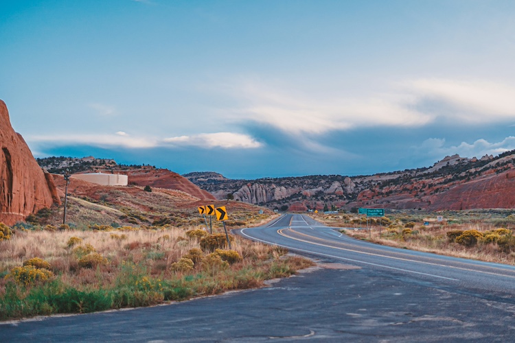
From Grants, our route left Route 66 to avoid a long section of interstate with no shoulder. Instead we pedaled south along NM 53 on a back road to Gallup. Stock up, it’s miles of wide open land and sky, beautiful and peaceful. It’s also an easy way to get up and over the Continental Divide — we hardly noticed pedaling over it at a mere 7,882 feet.
We stopped at the El Morro National Monument to see the cliff where travelers scratched their names in the rocks for hundreds of years, marveled at the light across Dowa Yalanne (Corn Mesa), visited the artists of Zuni, and enjoyed riding through the beautiful American West on the way to Gallup.
Gallup, New Mexico, was the center of the Western film industry from roughly 1929 to 1964, and all the big stars were here. In the El Rancho Hotel, their autographed photos line the walls, and we slaked our road thirst with a cold beer in the hotel bar, the same one that John Wayne rode into on his horse and reputedly said “Give me a beer. Give my horse a beer too.”
For us, it was the end of the first section of our Route 66 adventure, but that old highway still stretched out in the distance to the west.
There are many ways to ride Route 66. You can do it for the diversity and beauty of the route, just skimming over the history. Or you can dig deep into it, seek out the Route 66 fanatics that live in every town along the way, and ask them to share their knowledge. Then pedal out again and seek out all the old pieces of the route’s history that are out there, slowly fading away but still waiting for you to discover them.
![]()
Route 66 Nuts and Bolts
When to Go
The route runs from the northern climes of the Midwest through the southern U.S. deserts, so the weather is a factor. You could encounter both very hot and very cold. And it depends which way you want to ride it, Illinois to California, or the opposite. If starting in Illinois, late summer or early fall would be ideal so you would pass through the desert when the days are cooler. If starting in California, you could start in late winter to reach the Midwest in the spring or early summer.
What to Ride
We rode road bikes with 25mm tires. This worked well, but these would be too narrow for most of the dirt roads or side rough sections. Next time I will ride a standard touring bike with something in the range of a 32mm tire. Panniers or a trailer would be effective. You can also vehicle support this entire route if desired.
Where to Stay
I think a mix of camping and classic hotels would be ideal along the whole route. Some of the original hotels are pretty cool, but there aren’t many left. The ACA maps will mark all the campgrounds along the way.
Books to Read
The Grapes of Wrath by John Steinbeck
Route 66 – The Mother Road by Michael Wallis
Route 66 Sightings by Jerry McClanahan, Jim Ross, and Shellee Graham
The post Route 66 Is About to Turn 100, and There’s Never Been a Better Time to Ride It appeared first on Adventure Cycling Association.